BRIDGING THE GAPS: Mother Nature is not cooperating with repair efforts on Highway 12
BRIDGING THE GAPS: Mother Nature is not cooperating
with repair efforts on Highway 12
Strong northeast winds over the weekend created powerful ocean swells that pelted the Outer Banks coastline for the last four days.
For the workers who are putting in long hours to restore road access to Hatteras Island, this is yet another weather-related setback.
For the people who depend on Highway 12 for deliveries and for business, it was more heartbreak for a local economy that is nearly crippled by the fallout from Hurricane Irene.
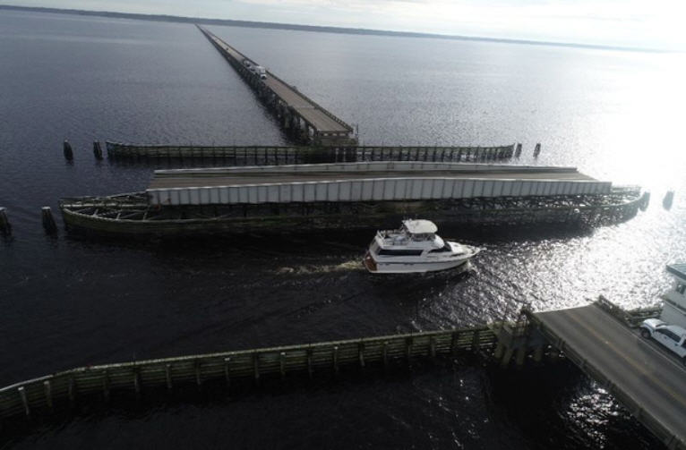
There are two distinctly different work agendas happening on each side of the New New Inlet that divides Highway 12 on Pea Island.
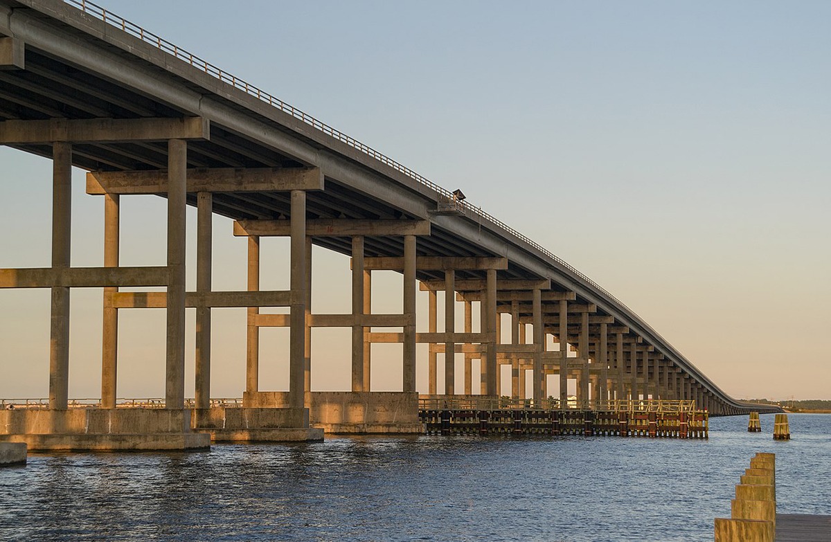
North of the break, work is centered on building the temporary metal bridge that will be pushed across the inlet in due time. Many pieces appear to be in place and already, some of the bridge is suspended over the inlet.
South of the break, the ocean continues to undo recent work at the receiving end of the bridge and also at the Mirlo Inlet site located at the S-curves north of Rodanthe, five miles south.
According to one worker for Carolina Bridge Co., about four days of progress was erased this weekend by the ocean’s big waves that widened the inlet and undermined previous work.
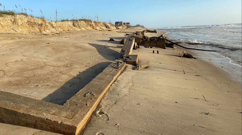
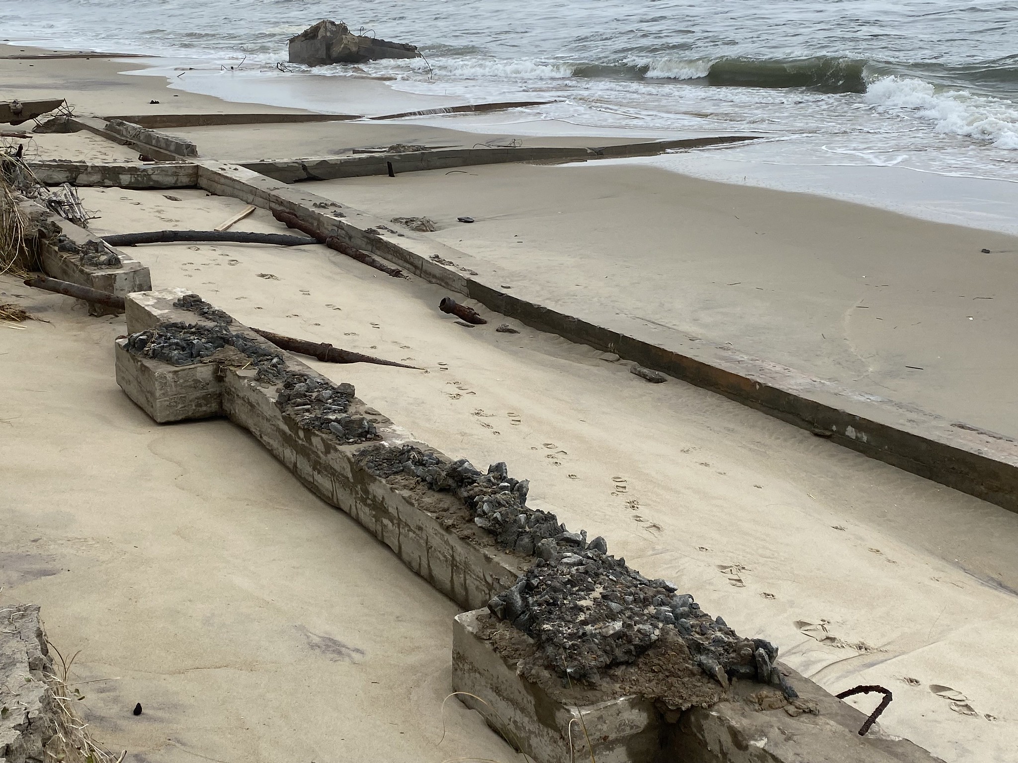
The old ranger station and former Pea Island refuge headquarters, which was built in the early 1960s and was irreparably damaged by Hurricane Irene fell into the New New Inlet on Sunday afternoon.
On Monday, the ocean swell was a little smaller, but the water was moving very fast — like a river running downhill through the inlet — and continued to cause significant erosion on the south side.
Carolina Bridge Co. had placed some large pipes and materials near the inlet but has been unable to start work with them due to the high surf.
Ocean water continued to wash over just south of the inlet, which tested the remnants of Highway 12 that was barely patched together with tons of sand trucked in from Avon.
Sandbags were added to protect the north part of this repair.
Tractor trailers are now trucking large metal plates to the New New Inlet that will be used to build a retaining wall that will receive the temporary bridge.
There is a lot more equipment, materials, and crews around this area, preparing for the time when ocean swell dies out.
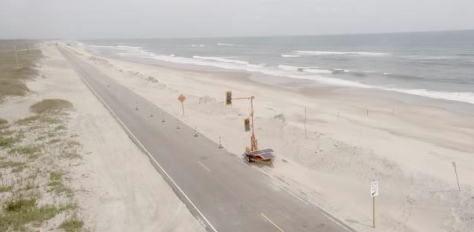
To the south, the area in the S-curves just north of Mirlo Beach continues to be a battleground as truckload after truckload of sand is added to the dune to keep the fragile road open so work can continue further north.
At high tide on Monday, breaking waves were still cresting the very tall manmade dune line, which was much larger than a week ago. Sand continued to be dumped here nonstop.
There was more damage to the houses and driveways over the weekend at Mirlo Beach.
Concrete driveways were undermined and broken up on both sides of the road. Foamy ocean water poured between the oceanfront houses. A piece of equipment pushed sand to form small barriers to hold this water back, so the heavy equipment could continue north and cross the area where little Mirlo Inlet flowed until last week.
The side road in front of the ocean houses used by trucks last week is no longer able to be utilized because of the recent damage caused by this latest weather event.
There is no doubt that the repair project would be a lot further along if the ocean hadn’t been so active over the last three weeks. There have been very few days when the ocean has been calm since Hurricane Irene crossed the region Aug. 27.
The wind is forecast to blow much less for the next several days, so workers are hoping to stop fighting Mother Nature and concentrate on moving forward.
October is not that far away, and there is a lot of work to be done. To date, all the crews have achieved amazing results. Now it’s time for a little Lady Luck.
(About the slide show: The photos were taken on Monday, Sept. 19, on the south side of New New Inlet on Pea Island. Some of the photos show the old yellow brick ranger station and refuge headquarters, built in the 1960s, which collapsed into the inlet on Sunday, Sept. 18. Other photos were taken at the site of another inlet on the north end of Rodanthe near the S-curves.)
ADDITIONAL INFORMATION
The Sept. 19 update from the North Carolina Department of Transportation included these figures on the progress of the temporary repairs:
Temporary Bridge Facts:
Piling: 29 piles driven out of 82 total piles.
Sheet Piling Bulkhead: 374 linear feet out of 1,096 total linear feet.
Concrete Footings: 2 footings poured out of 12 total footings.
Bridge Truss Spans: 89 linear feet out of 662 total linear feet.
These statistics on the progress of the bridge have not changed since last Friday’s report.
The Department of Transportation is still saying that the temporary bridge will be completed by early October.
MORE ISLAND FREE PRESS COVERAGE ON REPAIRING THE GAPS:
NCDOT update for Sept. 16
NCDOT update for Sept. 13 WITH SLIDE SHOW
Good Weather is forecast for Highway 12 repair efforts (Sept. 10) WITH SLIDE SHOW
High seas from Katia suspend road work Thursday night (Sept. 9) WITH SLIDE SHOW
Pieces of temporary bridge arriving daily (Sept. 9) WITH VIDEO
Progress on Highway 12 is going blazing fast (Sept. 8) WITH SLIDE SHOW
Repairing Highway 12 begins at Mirlo Beach (Sept. 6) WITH SLIDE SHOW
Temporary fix for Highway 12 may open road within a month (Sept. 2)
Subject
Name
(required, will not be published)
(required, will not be published)
City :
State :
Your Comments:
May be posted on the Letters to the Editor page at the discretion of the editor.
May be posted on the Letters to the Editor page at the discretion of the editor.
May be posted on the Letters to the Editor page at the discretion of the editor.
May be posted on the Letters to the Editor page at the discretion of the editor.